You are using an outdated browser. Please
upgrade your browser to improve your experience.
altitude speed location
by jwestveer
altitude speed location
by jwestveer
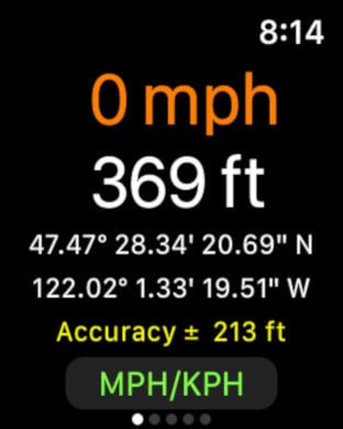
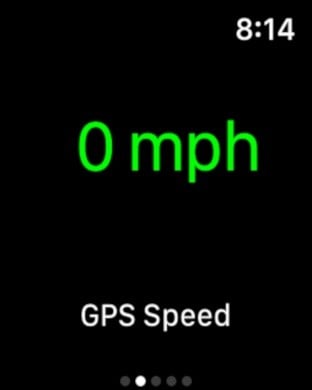
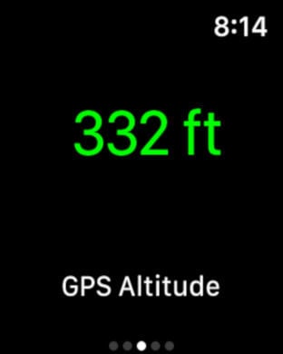
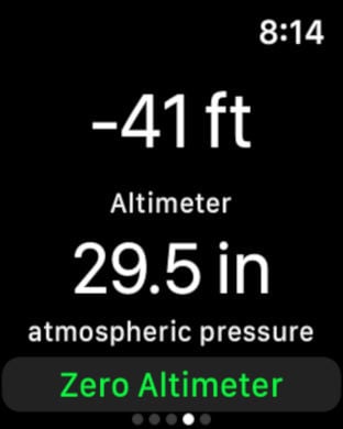
Our goal is to get as many environmental varables as possible together in one place when you are walking, hiking, biking, or driving. Altitude Speed Location (ASL) provides you with information about your current location. Have you ever wondered how fast you were traveling? What direction, how much altitude you may have gained travelling up a mountain path? ASL provides all this information and more, either on your iPhone, on your Apple Watch, or on your iPad.Maping data is dependant upon wifi or a cellular wireless connection to be able to download map images to the device. However the GPS functions of the Apple Watch, iPhone, and iPad are available virtually around the globe as long as you can see blue sky. Note: GPS will most likely NOT work when you are splunking in caves and underground caverns. The Altimeter functions not only give you air pressure, but also relative distance above and below your starting reference position, and that information is available anywhere there is air.You can swipe to step between different screens of text and graphic displays that include street maps, satelite maps, and enviornment data. All measurements can be displayed in imperial or metric units. ASL is ADD FREE, and we collect no data from our users. We appreciate feedback, and read all correspondence.
Features